As a child, my family’s property had what we called “the old roads”. These were flat roads, of packed earth overgrown with brambles and grass, that were running perpendicular to the slope of the mountain. They ran directly north to south. Someone had made these perfectly level, with a bank on the lower side, and they went quite far. There were two of them, an upper “road” and a “lower road” about 100 or so feet down the mountain. My father told me that they were “old roads” and he had no idea how long they had been there or where they had gone–just that they were there. We played on these old roads, walked them, built cabins on them, and thought nothing of them. Who knows the history of these “old roads”, their straightness and alignment seeming out of place in a more modern time.

So many remnants of ancient roads, of ley lines and trackways, infused with sacred purpose and intent, can still be found in the out-of-the-way places on our landscape around the world–on every continent where humans have lived. These roads represent a different era of human consciousness, an era when landscapes were infused with magical power, and where humans literally lived and moved at the intersection of the physical and the metaphysical. While the term “leys” currently has a number of conflicting meanings, I’d like to delve into the earth-based discipline of ley lines and what they were, historically, as a precursor to discussing work that we might do to re-enchant the land using some of these ancient principles.
In last week’s post, I introduced the concept of the “re-enchantment of the world” after exploring the “disenchantment” that has taken place in the hearts and minds of modern humans, and through the destruction of the physical landscape due to industrialization. The basic argument was that the world is already an enchanted place, even if many humans fail to see it, but as earth-honoring people, we can work to make it even more so. But in order to think about how we might re-enchant the world, it is useful to know what ancient humans did, how they created sacred landscapes in collaboration with nature for many different purposes. In order to continue to explore this, then, today’s post delves into the history of the World’s ley lines through a review and discussion of the work of Alfred Watkins Old Straight Track book and the work of Nigel Pennick and Paul Devereux in Lines Upon the Landscape. And so, let’s go ahead and dive into ley line history in order that we may build something anew.
Defining Ley Lines
Before I can talk about the ancient systems of human alignment that were originally known as “leys”, I want to start with some definitions. When one says “ley lines” today, chances are, they are talking about “energetic” lines, lines that run across the landscape and carry energy in various ways. These energetic lines, and the idea of lines of energy in a grid, tied to the earth’s magnetism, is the most common definition. These ideas rose over the 20th century with the works of W. Y. Evans Wentz, Dion Fortune, and John Mitchell. I will be talking about energetic understandings of leys in next week’s post–but this week, we are going to delve into physical alignments along the landscape. But to be clear–even if a ley traditionally means a physical alignment, as this post will show, the physical alignments reflected metaphysical and spiritual understandings of the world.
Sacred Alignment and Straight Lines
A key feature of the ley lines throughout the world, including in the UK, is that they are straight–very straight. They do not deviate from their straightness, even if it means going over a mountain, over a river, and so forth. To the ancient peoples all over the world, there was something very sacred in a straight line path. Pennick and Devereux note that straight-line features were regarded as sacred, and they write, “The fact remains that the further back in time we go we can see that the engineering of straight linear landscape features, even if for ostensibly utilitarian purposes, was accompanied by a sense of veneration. Even the Romans, we have seen, had wayside deities and gods of the survey….in recent times, straight landscape lines have been simply a form of fashion, or utilitarian, for geodesy or a means of getting wheeled transport from one port to another in the shortest distance.” (246). They note that as Western history moved on, the sacredness of ancient alignments moved to the profane (246). Today, it is hard to fathom that a landscape could have once been infused with such sacredness.
The Old Straight Track: Features of Ley Lines in the UK

Alfred Watkins, in The Old Straight Track, wrote about his findings concerning what he called “Ley lines” in Britain. The most traditional use of the term “Ley” is as Watkins coined it–it is a feature of “alignment”, or as he writes, “alignment across miles of country of a great number of objects, or sites of objects, of prehistoric antiquity…straight trackways in prehistorical times in Britain…the old straight track decided the site of almost every branch of human communal activity” (xx). Watkins discovered these leys after extensive fieldwork all over the British Isles and studying maps. Watkins chose the name “ley” (which has many different spellings/forms: leigh, lay, lee, lea, leye (153) due to his understanding of more prehistoric etymology based on place names (159). Another term he uses is “old straight track” for the leys.
Leys in the UK often include multiple objects over many miles, with physical markers (mounds, mark stones, standing stones, sacred sites, churches) at various points along the ley. I want to share some of the features of the British ley systems because I think knowing this information can help s as we envision our own sacred landscape features.
- Straight lines: As noted above, ley lines are straight–over many miles.
- Mounds: Mounds, according to Watkins, are “a separate heap of earth, or earth in stones, usually circular in form, but sometimes of a longer shape. The word is also used to infer an artificial structure, not a natural knowledge, although such a natural high point was often emphasized by slight artificial addition, and then became included in the designation.” (1) Some of the mounds are long, others are round or oval (2). Further, some mounds have a concave top, almost like a mound with a bowl at the top. They are often placed across ridges or high points; and were arranged so that as travelers walked them, they could be hidden from people who might be below (3). Mounds are part of the ley system.
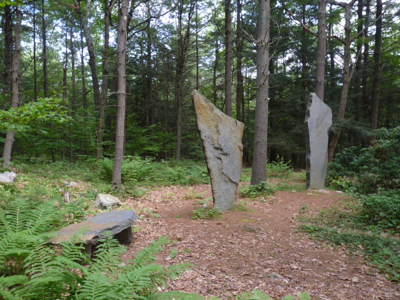
- Mark Stones: Mark stones are distinguished somehow from other stones naturally occurring in the area, either by shape, size, or appearance; Watkins notes that the smallest mark stones are a foot or less high and are typically distinctive but unworked, but often of altar shape. Watkins surmises that the purpose of these stones was to let the traveler know that he or she was on the right track. Many of them are planted near sighting mounds, to signal the direction of the ley and others are placed at the crossing of two leys. Some in Great Britain also have clear grooves; Watkins believes they may have been set with lights (23-25). Many of the stones that Watkins describes are also named and the names persist to this day. Watkins notes that many mark stones are places of assembly for people or even for sacred work or ritual (143).
- Trackways: Watkins was able to see, in many places, the physical pathways still marked (with mark stones) along the landscape. People had clearly used them for travel, by foot, or with a pack animal (but not a wheeled vehicle) (40). Wheeled vehicles would have been to large for the ancient Leys that Watkins mapped, indicating they were created before wheeled vehicles were used. Watkins notes that tree lines were often planted along the old trackways. Even if a more modern road or track swerves away from the ley (the alignment between two points), the trackway will come back in alignment with the ley at the point where two leys cross (37).
- Water: Ley lines were often constructed with water features; Watkins describes moated mounds (45) as well as other small ponds (possibly human-created) with small islands that leys run right through. Watkins surmises that it is possible that water features helped people follow the leys in the darkness, specifically using the “beacon hills” described next.
- Beacon Hills: Likewise, Beacon hills were part of the ley network that Watkins outlines; these were likely used for pagan celebrations of Beltane (he notes the terms “May hill” or “Beltany Hill” for beacon hill names (110)). Watkins notes that “beacon” and “beckon”, which are both Anglo-Saxon words, come from identical roots and mean “come to me.” (110). Watkins believes that by day, these beacon hill points could offer a signal of smoke during the day and a fire at night to light the way directly down the ley (112). He also notes that the use of water features would allow for the beacon fire to reflect from the water below, allowing someone who was on the high point near the beacon fire to see exactly the direction where to go in the night from the reflection on the water. This means that the leys were clearly used for day travel, night travel, as well as ceremonial purposes.
- Sighting Notches: These are large features, like a notch, road or deeply cut grove, through a mountain ridge. Watkins surmised that they were used as sight guidelines so that people who were on the valley floors know which way the trackway went (50).
- Initial points were where leys began: Often, a ley started with either a “natural rock structures used for early ritual or ceremonies” or some other kind of sacred feature, like a sacred well (58-59). This suggests that people may have used the ley line to travel to a particular sacred place: a well, a ritual space, by day or by night.
- Mark Trees: Trees were also likely used to mark ley lines, and he builds a good case that Scotch Fir (Pinnus Silvestris) as a primary ley line tree. Other trees he mention are oak, elm, yew, ash, and hawthorn (64).
- Camps: Watkins refers to ‘camps’ to mean areas that are enclosed areas, on high ground, with an earthen embankment (65); leys would touch the boundry wall of the camp.
- Sacred Sites: Watkins also describes other kinds of sacred sites, such as old churches (often built on older pagan sites), stone circles like Stonehenge, and the like that are also tied into the Ley network. (106). These ancient sites were aligned with the sun, and Watkins concludes that the sun alignment is also critical to the leys.
- Orientation/Direction: Watkins notes that orientation (direction the ley faced) was another key feature of ley lines. For example, Stonehenge’s road, on a ley line according to Watson, is oriented with the Midsummer sunrise (129). He also notes, however that many leys were not necessarily laid out with the sun, but for more “utilitarian” purposes of travel. This topic of orientation, particularly of churches and temples, was further taken up though John Michael Greer’s recent book The Secret of the Temple.
What Watkins was describing was a set of intentionally-created prehistoric alignments all over Great Britain. Certainty about what these lines were for, and how they were used, is lost to pre-history. It is clear that these leys, these alignments, had sacred intent and were used both for sacred and mundane purposes. However, as we’ll explore more next week, Pennick and Devereux take Watkins’ material, along with material from many other sources, and describe some likely uses of these ley lines in terms of a sacred landscape. I also will note that there are also deities associated with the pathways and trackways, like the antlered goddess, Elen of the Ways / Elen of the Old Straight Track.
This information above would be fascinating enough of it were relegated only to the UK. But As Devereux and Pennick demonstrate in Lines on the Landscape, these same features are replicated over and over again in the world.
The Etruscan Discipline: Sacred City Planning in the Graeco Roman Tradition
In other parts of Europe, for example, in the Graceo-Roman tradition, we again get the sense of the physical choices for placement being based on sacred intent. A very good example of this is the Etruscan Discipline. Discussed in Varro’s Antiquities (47 B.C.E), the Etruscan Discipline describes a sacred practice of straight-line planning that was used to survey, plan, and design all Roman cities. As Pennick and Devereux describe, the Etruscan Discipline was a system of divination, ritual, and processes that used augury and sacred geometry to lay out cities. Part of this work included dividing the landscape into quarters (north east, north west, south east, south west); this quarter division was the basic plan used for all Roman city planning (ironic how we still use sacred quarters!) Later in the process, the city plans were divided further into 8ths and 16ths. Each of these sections then, were dedicated to various deities: Gods/Goddesses of earth and nature being located in the south, the “chief deities” who helped humans in the north; the west held deities of fate and also the “infernal powers” (p. 97). Further, an auger engaging in the Etruscan discipline would look for various signs on heaven and earth: the flight of birds (particularly songbirds or flock birds), weather features (wind, clouds, lighting, storms, etc), and the heavens (astronomical features).

Of this process, Pennick and Devereux write, “With all of these factors assessed and assimilated, the newly founded city, or laid out road, would have the best possible inauguration, because the Etruscan Discipline was the reflection of objective spiritual processes and cosmic laws through the medium of a technique which accessed information directly from nature. By founding the undertaking at both the right place and the right time, according to prescribed rules, the venture would be in harmony with both the material and non-material worlds. The Etruscan discipline thus expressed a world view in which the material reflects the spiritual and the spiritual is revealed in the material.” (p. 98).
The Etruscan discipline is one of many, many sacred pieces that ancient Europeans used to create sacred landscapes.
Lines in North America
On the other side of the world, Ancient Native North Americans also used straignt line features, or what Pennick and Devereux call “Linear Earthworks.” We have far less information about the Native Peoples and what they did with these earthworks due to the genocide of the Native North Americans, but the physical features are still present in some places on the landscape.
The Adena peoples, who lived more than 3000 years in what is modern-day Ohio and Pennsylvania, created elaborate earthworks. These earthworks included burial mounds and sacred circles (of up to 200 feet in diameter), sometimes with other geometric features. One such mound is the Serpent Mound in Peeble, Ohio.The Hopewell, were a tribe of trade-oriented native people that lived around 150 BCE to 500 CE, also in the Ohio valley. They, likewise, produced elaborate mounds with complex and precise geometrical earthworks. These earthworks included giant circles, squares, and straight parallel lines running outward from the circles. Other such earthwork features have been documented in Georgia, Mississippi, and California.
Although there is much less documentation than on the leys in Europe, the North American Indians also had a “straight track” system of trails. These are poorly documented in many regions, but the 19570 Laetitia Sample described them as follows, “The trails on the sierra regions followed natural passes….They seem to have gone on straight lines…without detouring for mountains along the way…trails were marked in various ways… sometimes piles of twigs or cairns of stone along a trail have been called markers. ” (Quoted in Pennick and Deverux, p. 171). The Anasazi people, likewise, created “arrow straight” roads demonstrating that they had some advanced surveying systems to lay out their roads in straight lines (p. 175). The Anasazi roads are a great mystery–they have parallel features to the roads, they are much too wide for a culture that did not have wheeled vehicles, and there is evidence that they connect potentially sacred sites/locales (known as the Great Houses). Pennick and Devereux suggest that the evidence points to the roads themselves as holy; other archeologists have labeled them “ceremonial highways” (p.179).
These are several of many such documented “straight line” trails– others exist in Arizona, Colorado, New Mexico, Utah, and more. Pennick and Devereux note that many more Native American earthworks and straight tracks all over the east and central USA that have been destroyed with modern farming, road construction, and so on. Many such straight tracks and trails in the East are now non-existent due to this kind of activity.
Other Straight Line Feature Globally
Pennick and Devereux detail many other “straight line” features around the world: those created by the ancient Mayans, the ancient Inca, and the Aztecs. The ancient Aztecs had a very elaborate system of straight lines on the deserts that are still visible (p. 182) and likely were representations of astronomical features. The lines can only really be appreciated from the air, however, calling into question what exactly the Aztecs were building the lines for! Likewise, lines can be found in the Islamic world, in China, Japan, and Indonesia. As this post is getting long, I’ll refrain from going into more details on these lines if you are interested, you can read Lines on the Landscape for more details.


Hi Dana,
I love this post. I have read John Mitchell and others and visited some of the sites in England. Thank you for keeping us attuned to the earth energies through your posts.
Francesca
Sent from Mail for Windows 10
You are most welcome, Francesca! Thanks for your comment and for reading!
Reblogged this on Paths I Walk.
Thank you for the reblog!
Thank you for this post. I knew there were differences in the structures. I just was not quite understanding. This also links Shamanism too. I could see how the Native American traditions were different, yet similar. This was a wonderful post. Thank you! It us a shame that there us do little effort now afaya to preserve our lands and reconnect.
Thank you for reading, Casey! I am just amazed at how “universal” these practices are–just like shamanism, which is practiced in different forms around the world.
Reblogged this on Rattiesforeverworldpresscom.
So informative and inspiring! I plan to share this quote with my FB group, along with a link to the post “… the world is already an enchanted place, even if many humans fail to see it, but as earth-honoring people, we can work to make it even more so.” Shall I refer to you as Dana @druidgarden.wordpress.com or is there a surname I can also note? I will also tag your FB page. BTW are you on instagram?
Thanks for the comment, Della! You can actually share the Druid’s Garden Facebook page (where I post everything from the blog):
https://www.facebook.com/druidgarden/
There should be a post there today to share, if you’d like. Dana is fine 🙂
I do have an instagram, but it is primarily for my artwork:
https://www.instagram.com/druidsgardenart/
Thank you so much Dana! Yes, I’ll share the Facebook link as well as the main site… and will start following on Instagram from my own pages 🙏🏻
Slightly unrelated, I know you work on some publications for different Druid orders, but do you have a book out yet? I would love to see the insights you share here on the blog in a book form. We could use a beautiful treatise on combining Druidry and Permaculture!
Watkins notes that “beacon” and “beckon”, which are both Anglo Saxon words, come from identical roots and mean “come to me.” I love tidbits like this. It’s like finding a little piece of quartz crystal in the rocky places while on a hike. You may wish to read “The Old Ways: A Journey on Foot” by Robert McFarlane which goes into this topic somewhat. Worth a read.
Where can I learn more about the antlered goddess Elen of the Ways? I’ve never heard of her before and would like to learn more. If you can point me in the right direction, I would appreciate it. 🙂
There is a good book that was published a few years ago called “Finding Elen: The Quest for Elen of the Ways” by Caroline Wise. That would be a good place to start!
Thank you 🙂